


Since the end of World War II, nearly every metropolitan and micropolitan area of the United States began to sprawl outwards as (mostly white) families sought wide open spaces, homeownership and their personal fulfillment of the American Dream. Following this trend, the Champaign-Urbana area has roughly doubled in population and increased its geographical footprint by a little more than double since the 50’s; however, the growth remained fairly compact in relation to its counterparts. This trend of infill (on pre-developed lots within an urbanized area) as opposed to greenfield (on farmland or other open land) development has been more striking in the last decade than at any other time in recent memory, following over a half-century of sprawl that brought Country Fair, Market Place, and North Prospect to the area while purging business from downtown Urbana and Champaign.
Developments in Campustown and downtown Champaign and Urbana now comprise the lion’s share of new construction in the area. Many of these are apartments, but hotels and smaller commercial developments are also common. Among the few greenfield developments, there seems to be an interest among developers to recreate some of the characteristics of traditional neighborhoods; Carle at the Fields, for example, incorporates residences, offices, shops, and services in what is shaping up to be a cohesive semi-urban environment. Despite this, other low-density development envisioned on the fringe has yet to materialize; High Cross Road only supports a Walmart and Aldi in what was supposed to be a regional commercial corridor, Pinehurst Commons at Olympian and Prospect has only three of its lots developed, and the Clearview Office Park has never developed and the developers is exploring other options for the site at the northwest extremity of C-U. While this change in preference has left some empty lots on the outskirts of the two cities, the economics are advantageous for C-U residents at large.
![]() The plan for Clearview (Image from Clearview website)
The plan for Clearview (Image from Clearview website)
The most notable of these is that denser development produces higher property tax revenue, which helps benefit public schools, parks, and services in the area. This same revenue also aids in the maintenance of infrastructure; high density neighborhoods reduce the per-person cost of upkeep, while low-density neighborhoods (think detached houses and strip malls) require the same public investment (in pipes, potholes, etc.) while contributing less revenue to their respective cities or special districts. Oftentimes, these costs are backloaded. A developer will usually pay for the construction of infrastructure in a given subdivision but the cost of maintaining it is then shifted to the public once it is completed. Lastly, building vertically, rather than horizontally, is better for the environment, as less natural or rural habitat is gobbled up for human activity, people are less likely to use polluting automobiles for errands, and multifamily dwellings (such as apartments, townhomes, or condos) require far less energy to heat and cool on average than detached homes. Of course, as infill development ramps up, governments must take action to remain proactive in maintaining housing affordability and preserving important pieces of local history and architecture.
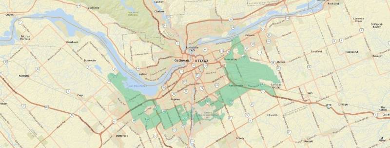 Image from National Capital Commision
So how can the area continue to rethink its underperforming urbanized spaces while accommodating growth? Some states mandate that cities limit how far its cities and towns can expand their footprint by way of an urban growth boundary, or UGB; Illinois has no such mandate, nor is there much evidence to prove its effectiveness. Portland, Oregon, has expanded its boundary 35 times since its 1979 inception and low-density neighborhoods are still very common inside the boundary, affordability is also an issue. A more feasible alternative can be found in our neighbor to the north. Ottawa, Ontario, Canada’s national capital, implemented a “greenbelt,” which does not fully restrict outward growth, but instead preserves open space and forests outside of the urbanized area. It forms a ring of open space around much of the city and balances public space with agricultural activity, it also affords the opportunity for development outside the greenbelt, should there be a need.
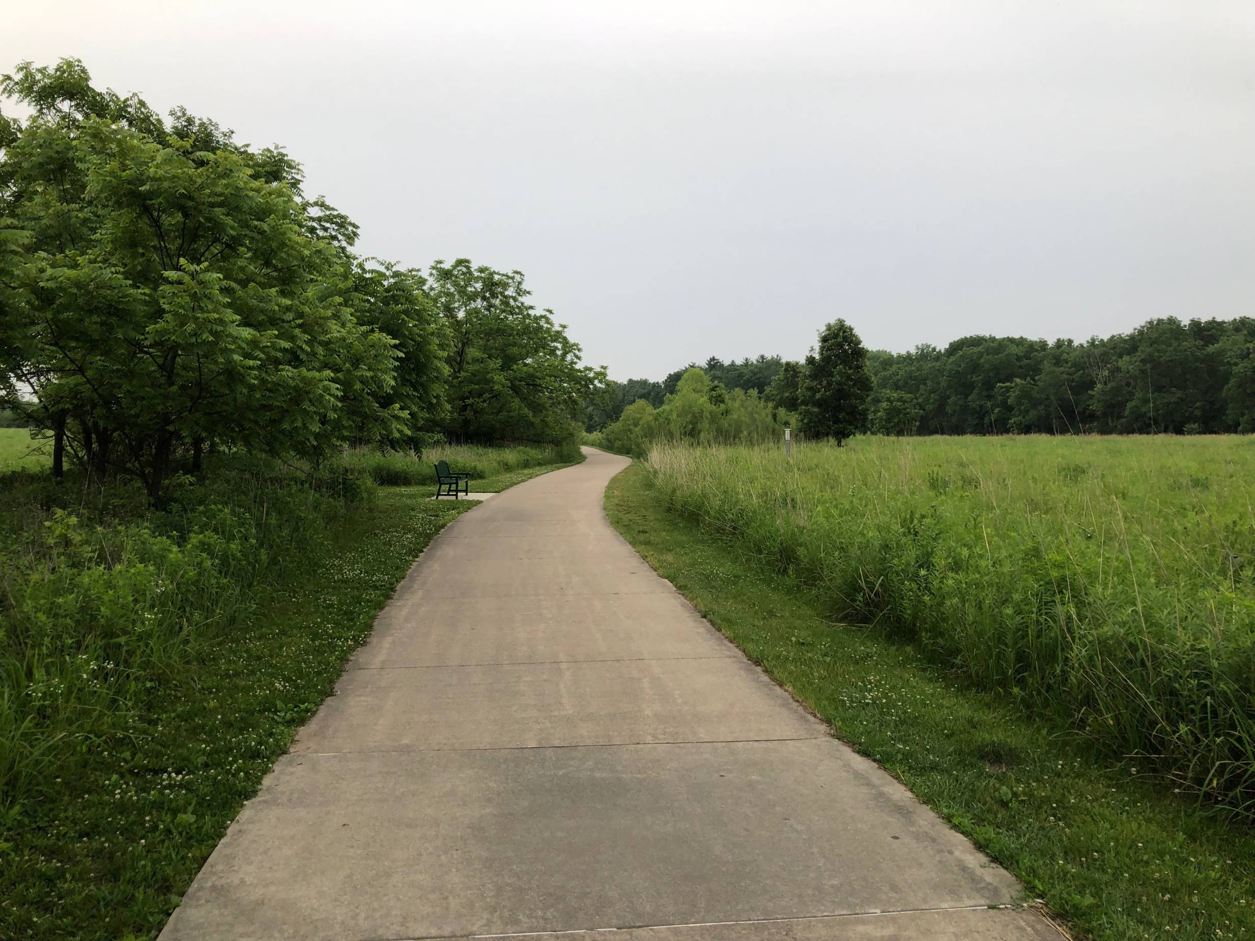
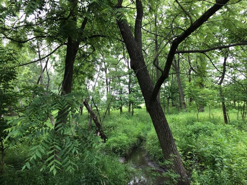 Photo by Andrew Dunham
There isn’t much in terms of forests outside of Champaign-Urbana, but preserving the availability of open space on the towns’ outskirts can serve an environmental public good allow residents to easily escape to a bucolic landscape. Along this ring, parks with native plants and other setting-appropriate features can be gradually constructed on land that becomes available. Meadowbrook Park, with its preserve prairies and forests, serves as an excellent example of how to incorporate natural features into a public setting. It is scalable for locations like the Saline Branch area, which lies just to the east of Urbana proper.
For a successful greenbelt, there must be strong collaboration between the Champaign, Savoy, Urbana, and county governments; strong communication with and consideration for area stakeholders; and zoning that can accommodate near-term outward growth as well as growth within existing neighborhoods. As it develops, trails and other features can link greenbelt parks together and connect to locations in the cities to encourage more residents to explore the countryside. This is a complicated and lengthy process; however, the end result of sustainability, urban vibrancy, and appreciation for eastern Illinois’s subtly beautiful landscape may be enough to justify the effort.
Top photo by Andrew Dunham