


September closes more like the final month of summer than the first month of climatological fall. In fact, the month finished on a streak of 21 consecutive days with warmer than average temperatures. That streak continued right into October, ending a run of 24 straight days above average. September also used a late push with some strong storms late in the final days of the month to finish just barely above average overall.
The average temperature for September in Champaign-Urbana finishes at 72.3 degrees, 6.6 degrees above the monthly average of 66.2 degrees. We finished with 3.36″ of rain, 0.23″ above the average of 3.13″.
In Champaign-Urbana, the month of September got off to a cooler start! The first week saw temperatures either near average, or a few degrees below. High temperatures the first week were mostly pleasant, in the 70s, with overnight lows falling into the 50s. We saw a change around September 9th/10th with the overall jet stream pattern across North America, one that pushed summer-like air into the region.
This pattern ended up getting stuck in what’s known as a “blocking pattern”. This means the ridge of high pressure over the eastern half of the United States which has brought the warm air into the region sets up shop, and deflects storm systems with beneficial rainfall and any attempts at cooler air off to our north. This same pattern displaces a lot of cold air into portions of the Pacific Northwest. While we were baking in summer heat, parts of the Canadian Prairie and Montana saw their first snowstorm. It’s a yin and yang situation, in a way.
This is why we’re often so dry in the summer, and why up until the last week of the month we were on pace for a drier than average September.
During that stretch of 21 days warmer than average to end the month, nine of those days saw temperatures over 10 degrees warmer than average, with the Twin Cities hitting 90 degrees four times between the 10th and 30th. We set a record “warm-low” on September 11th, when the overnight low temperature only dropped to 70 degrees. That’s the stuff of July!
Rainfall was pretty sporadic with high pressure dominating the region mid-late month. More substantial storm systems began to work their way into the region during the last week of the month. Our biggest rainfall came on September 29th, when a severe thunderstorm moved through the area dropping 1.04″ of rain in Champaign-Urbana, and producing large hail and damaging winds that destroyed some farmland near Seymour, IL. This storm also put on a spectacular show, taking on a “mother ship” flying-saucer appearance as it glided across the northern half of Champaign County that Sunday evening.
Where are we headed for the rest of October? We started off warm, dealing with the last gasp of this summer pattern. Temperatures have since moderated to a more seasonally appropriate level. Looking ahead, I’m not concerned about summer trying to make a significant return. In fact, we’re probably done with any real sustained heat. Instead, we’ve got some chilly air booking tickets to Central Illinois for the coming weekend. By the time we get to the weekend of October 12-13, we’ll likely see our first overnight lows in the 30s, with afternoon high temperatures only in the 50s.
Heading into mid-October it does look like a mix of seasonally appropriate temperatures and a few reinforcing shots of cooler air seem likely. By October 20th, it’s possible that we’ll see a slightly warmer pattern return, but with that we’re likely talking about temperatures a few degrees warmer than average, which in late October typically means some very pleasant weather. With that, I’d expect a near average finish to the month overall here in C-U. That means our first frost, likely somewhere in the 2-3 week time frame.
We’ll see opportunities for precipitation, but at this time, they look fairly spaced out. Perhaps opportunities for rain and thunderstorms every 5 to 7 days. For now, I don’t see any advertisement of a setup where we see a stalled out frontal boundary, a pattern that leads to days and days of repeated rounds of rain and storms resulting in heavy rainfall and flooding like we saw a year ago.
Instead, the next 2-3 weeks look to be dominated mostly by quiet, high pressure, with passing fronts bringing a chance for rain every week or so. I’d count on October finishing in the dry category by the end of the month.
A seasonally appropriate, average October temperature-wise with mostly dry conditions here in Champaign-Urbana? I don’t think many would complain about that!
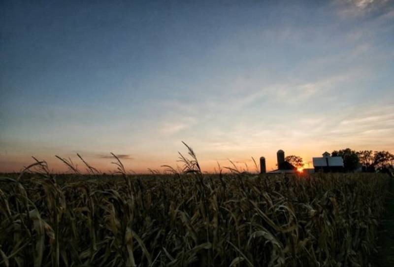
Photos by Andrew Pritchard