


At the end of my September recap, we previewed the month of October here in Champaign-Urbana. While discussing temperature trends I suggested we (1) were likely done with any remaining summer warmth that had begun to wear on folks, (2) that we’d likely see reinforcing shots of cooler air mid-month, but (3) may trend toward a slightly warmer pattern in the late month with a near-average finish to the month overall. October is a historically tricky month to forecast as we transition seasons, but I’ll have to go ahead and give myself a passing grade here.
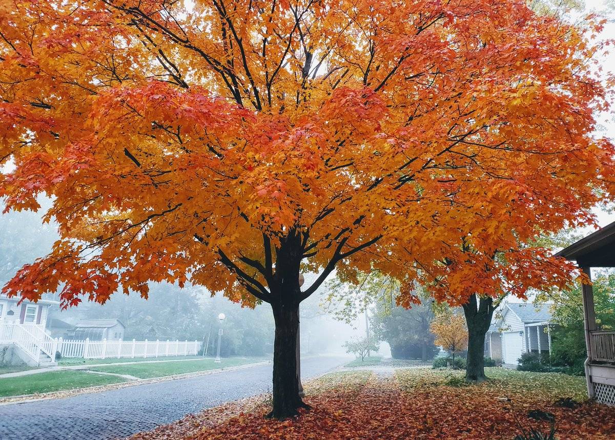
What wasn’t clear in early October, was the major cool-down we’d see in the last days of the month, including some Halloween snow. That said, the average temperature for the month of October 2019 in Champaign-Urbana was 54 degrees, 0.1 degrees off from the monthly average of 53.9 degrees. That’s pretty near-average.
Okay Mr. Weather-Human, how’d you do in the precipitation department? I suggested we’d see opportunities for precipitation, but that they’d be fairly spaced out and relatively light. Without any clues that we’d see a pattern that featured a stalled out frontal boundary or anything supportive of multiple days of repeated rounds of rain and storms resulting in heavy rainfall and flooding (such as what we saw in Fall 2018), I forecasted a drier than average October in the Twin Cities.
Up until October 27th, this was a great forecast! A slam dunk, even.
Once again, a late-month pattern change simply wasn’t obvious at the beginning of the month.
Through the first 26 days of October, we never saw greater than 0.35″ of rainfall on any given day, and only picked up measurable precipitation (0.1″ or more) on 8 of those 26 days. The monthly average for October precipitation in Champaign-Urbana is 3.26″. From October 1st to October 26th we picked up 1.13″ of precipitation, well on our way to a very dry month.
*record scratch, pattern change*
The final six days of October featured exactly the pattern outlined several paragraphs above; a stationary frontal boundary dividing very warm and humid air in the Southeastern U.S. and bitterly cold air in the Northwest provided the focus for the repeated development of heavy rain and storms. A very rainy Saturday, October 27th alone delivered 2.28″. This single day of rain brought the monthly total up from a dry 1.13″ to an above-average 3.41″. Another nearly two inches of rain in the following days brought the final October total to an even 5.00″.
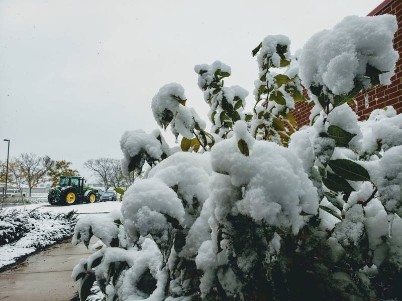
Of course, that wasn’t the only excitement that the major pattern change in late-October delivered. Halloween looked a little bit more like Christmas as several hours of heavy, wet snow coated grassy surfaces and vegetation in a layer of cement-like snow, with overnight low temperatures plunging into the 20s.
Looking ahead to November, it does look like this cold weather pattern has some staying power. The jet stream is a bit blocked up over the Pacific Ocean, which will keep a large ridge of high pressure over the Gulf of Alaska with a downstream trough of low pressure over the central and eastern U.S.
An alignment like that means nothing but cold air over the Midwest. The next 7-10 days or more should feature reinforcing shots of cold air being delivered from the Canadian Prairie. Our first overnight low temperatures in the teens are likely not far away. If we’re going to warm back up in any sort of lasting fashion in late-November, we’ll need the blocking pattern over the Pacific Ocean to break down and allow that ridge in the Gulf of Alaska to begin to progress eastward. That would allow the colder air mass locked overhead to begin to go move east and allow warmer air from the west to return.
For now, that ain’t happening. Into mid-November, expect cold temperatures, perhaps at times 10 to 20 degrees colder than average. The average high/low temperature in Champaign-Urbana in mid-November is roughly 50/35, so we may be talking about multi-day stretches with highs in the 30s and lows in the teens in the next 1-2 weeks.
Now don’t just totally submit yourselves to an early winter on all fronts. The colder pattern does not necessarily equal a snowy pattern. Instead, reinforcing shots of colder and drier air from Canada will be less supportive of significant precipitation. We may see clipper-like systems from the northwest that could deliver precipitation in light doses of showers or snow flurries, but precipitation is likely to be on the dry side at least into mid-November. With the suggestion that this stubborn jet stream alignment may stick around beyond the next 1-2 weeks, I’m inclined to believe that the month finishes drier overall barring a second consecutive late-month rally.
So ultimately, I’m calling for a colder and drier month of November in Champaign-Urbana.
For context, the average monthly temperature for November in C-U is 41.3 degrees and the average monthly precipitation is 3.68″. We also average 0.9″ of snow in November.
Andrew operates Chambana Weather, where he publishes daily weather information for Champaign-Urbana and surrounding communities.
Champaign-Urbana monthly climate statistics are courtesy of the Illinois State Water Survey.
Photos by Andrew Pritchard